Land-Use
 What is land use and how does that differ from sustainable land use?
A wise man once said, “Land use isn’t rocket science; it’s harder.”
According to Wikipedia, (http://en.wikipedia.org/wiki/Land_use) land use in its simplest form is defined as the "management and modification of natural environment or wilderness into built environment." That conventional kind of land use thinking helped our country to grow by leaps and bounds after World War II, but it also created a predominance of sprawling development patterns like strip mall shopping centers far from our downtowns, suburban subdivisions that are largely indistinguishable from one another, decimated wetlands, native prairies and woodlands, and an unhealthy dependence on our cars to get from one place to another.
 Sustainable land use is what a modern-day computer programmer might call, “Land Use 2.0.” It is the newer and more improved version. It is development that looks at the bigger picture and how what we do on the land is connected to everything else in our community. Sustainable land use makes it possible for communities to grow in ways that support strong local economies and jobs, create vibrant neighborhoods with a range of housing and transportation options, and achieve healthy communities that provide residents – both human and non-human – with a clean environment.
 Some common traits of sustainable land use include: compact development patterns; mixing of commercial and residential land uses, especially in our downtown cores; promoting development or redevelopment where infrastructure already exists; providing a range of housing choices for all incomes and all stages of life; providing safe transportation options that include biking, walking and mass transit; preserving open space, farmlands, natural beauty and critical environmental areas; and fostering distinctive, attractive communities that stimulate civic pride and offer residents a high quality of life and a strong sense of place.
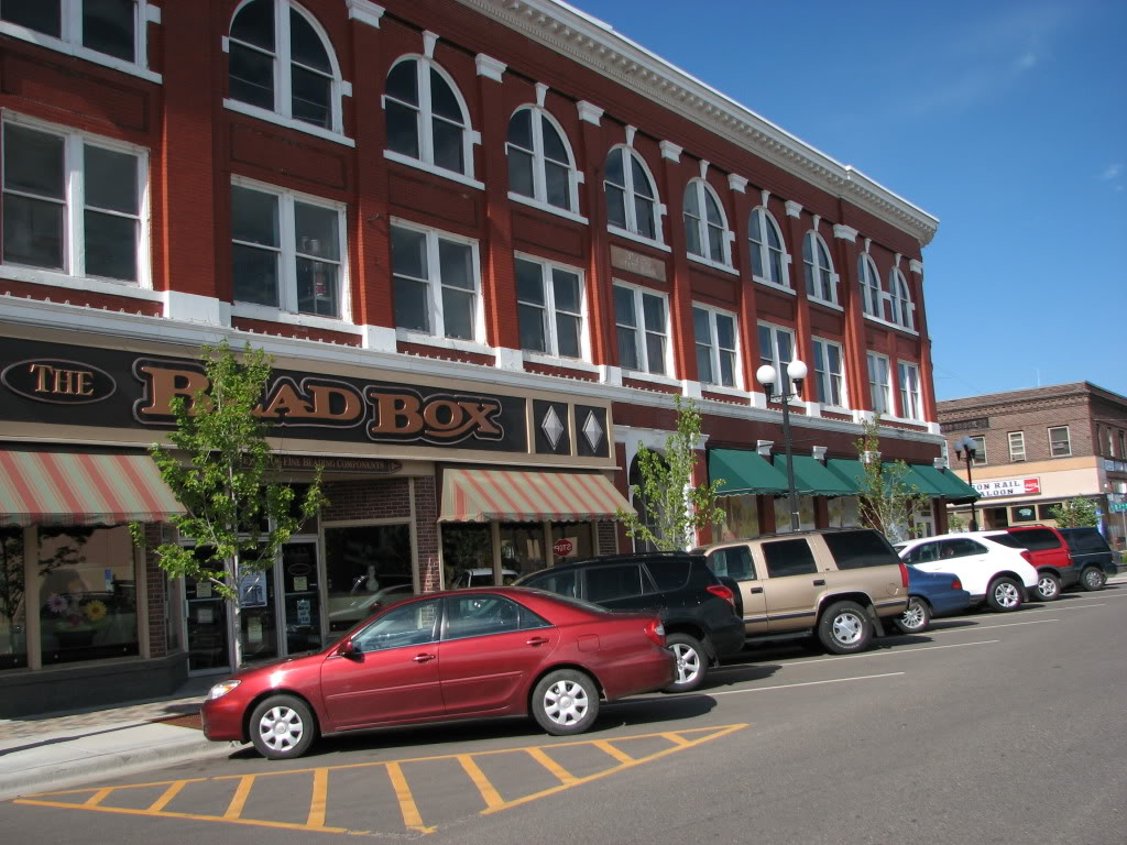 The communities that choose to grow by looking at land use as something more than just “management and modification of the natural environment or wilderness into built environment” will be the successful, healthy, vibrant, resilient, diverse, and fiscally sound communities of the future. Those are the places where people will want to live and visit and where businesses will want to locate.
Within this division of the website you will find a variety of resources that pertain to land use within the region.
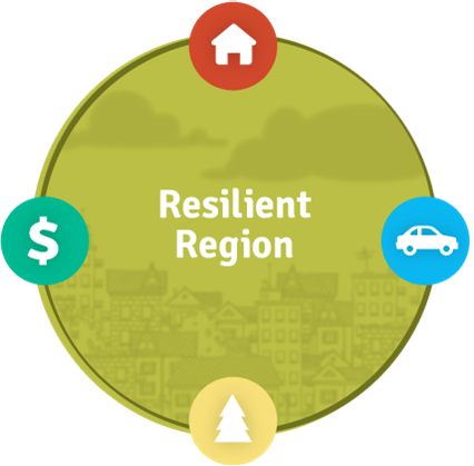
The Resilient Region Plan
Our Plan This plan was presented to the community at our celebration event August 14, 2012. It included the Livability Principles, Regional Guiding Principles, Vision and Values, and Issues, Goals, Recommendations, and Action Steps organized across 11 Themes. It addressed sustainable land use in a number of ways.
Table of Themes Cross Referenced with Principles & Source Land Use issues, goals, recommendations, and action steps may be found under Theme 4: Natural Resources & Development Patterns and the workgroup column codes beginning with "L" (Final Report Reference: Appendix B).
Regional Land Use Practices: How Central Minnesota Can Become More Sustainable was prepared by Phil Hunsicker, Lakes Regional Program Director, Envision Minnesota. This describes what was learned through the planning process regarding land use issues for the five-county region (Final Report Reference: Appendix F-1).
The planning work was also supported by students from the University of Minnesota and William Mitchel Law School.
 City: Land Use Policy Analysis John Sisser, University of Minnesota Regional Sustainable Development Partnership, analyzed the Long Prairie, Little Falls, Walker, Brainerd, and Wadena city policies related to Land Use (Final Report Reference: Appendix F-2).
Michael Dorfman, University of Minnesota Regional Sustainable Development Partnership, analyzed the Land Use Policies for Cass, Crow Wing, Morrison, Todd and Wadena Counties. County: Land Use Policy Analysis (Report Reference: Appendix F-3).
 Elizabeth Anne Lyons, Certified Student Attorney, and Diane Marie Dube, Supervising Attorney, from the William Mitchell College of Law conducted a legal research project for the Land Use Work Group.CMSDP Zoning Typology Memo. Review of Natural Resource Ordinancesby William Mitchell Law School helped to build the Policy Toolkit and Model Comp Plan (Final Report References: Appendix F-4 and F-5).
Model Comp Plan provides sample city and county policies to support sustainable land use. (Final Report Reference: Appendix I)
 Policy Toolkit A section of the Policy Toolkit provides a review of resources to: identify issue champions, obtain input from the public regarding land use issues, plan for staged expansion of existing development areas, determine if certain areas may be better candidates for conservation or open space than for intensified development, and bolstering regional food security. (Final Report Reference: Appendix H).
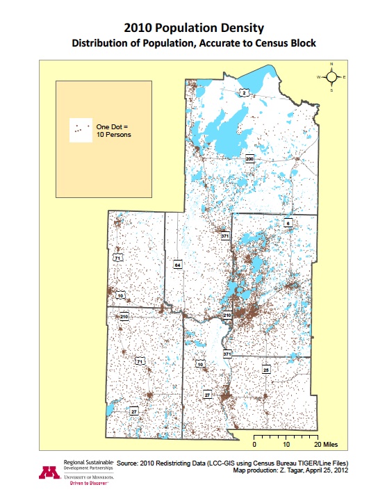
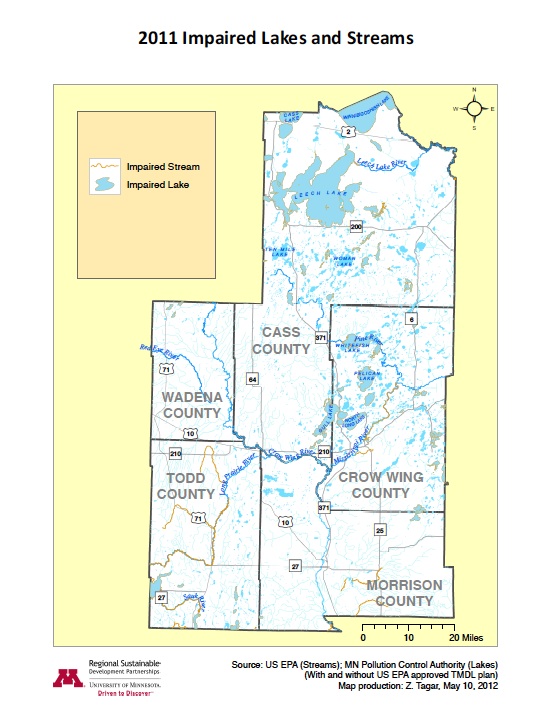
Map Narratives provide an analysis of the maps used to study the land use discipline. These include Impaired Lakes and Streams, Aquatic Invasive Species, Lakes, Streams and Water Access (Final Report Reference: Appendix F-6).
Land Use was integrated across the final resilient region plan. Land Use and Natural Resources were also highlighted in F-7 Theme 4: Land Use & Natural Resources Detail.
Resources for Sustainable Land Use: For more information about sustainable land use contact our partners:
 |
|
|
| EnVision Minnesota | Green Step Cities | |
|---|---|---|